
Solutions - Navview
Multibeam
Introducing an innovative multibeam acquisition software package, crafted specifically with the needs of our customers in mind. Experience unparalleled precision and efficiency tailored to enhance your workflow and elevate your projects.
Introduced in 2024, our multibeam extension for NavView is designed to plan and carry out multibeam surveys on surface vessels, ROVs, USVs, or AUVs. We have utilized the powerful tools within the NavView software suite to establish a new and reliable multibeam capability.
The key features that have been implemented include:
Planning
Data Collection
Quality Control
Data export
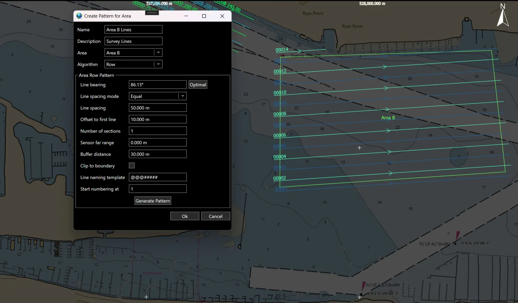
seamless and intuitive planning
Experience seamless and intuitive planning that adapts effortlessly to your needs, paired with versatile controls that empower you to navigate challenges confidently.
Conducting surveys involves creating a comprehensive plan that takes into account the types of sensors available, the area to be surveyed, and specific survey requirements such as overlap. We draw on our experience with AUV mission planning, particularly through our pioneering InfinityView software, which has been used to plan more commercial AUV missions than any other software.
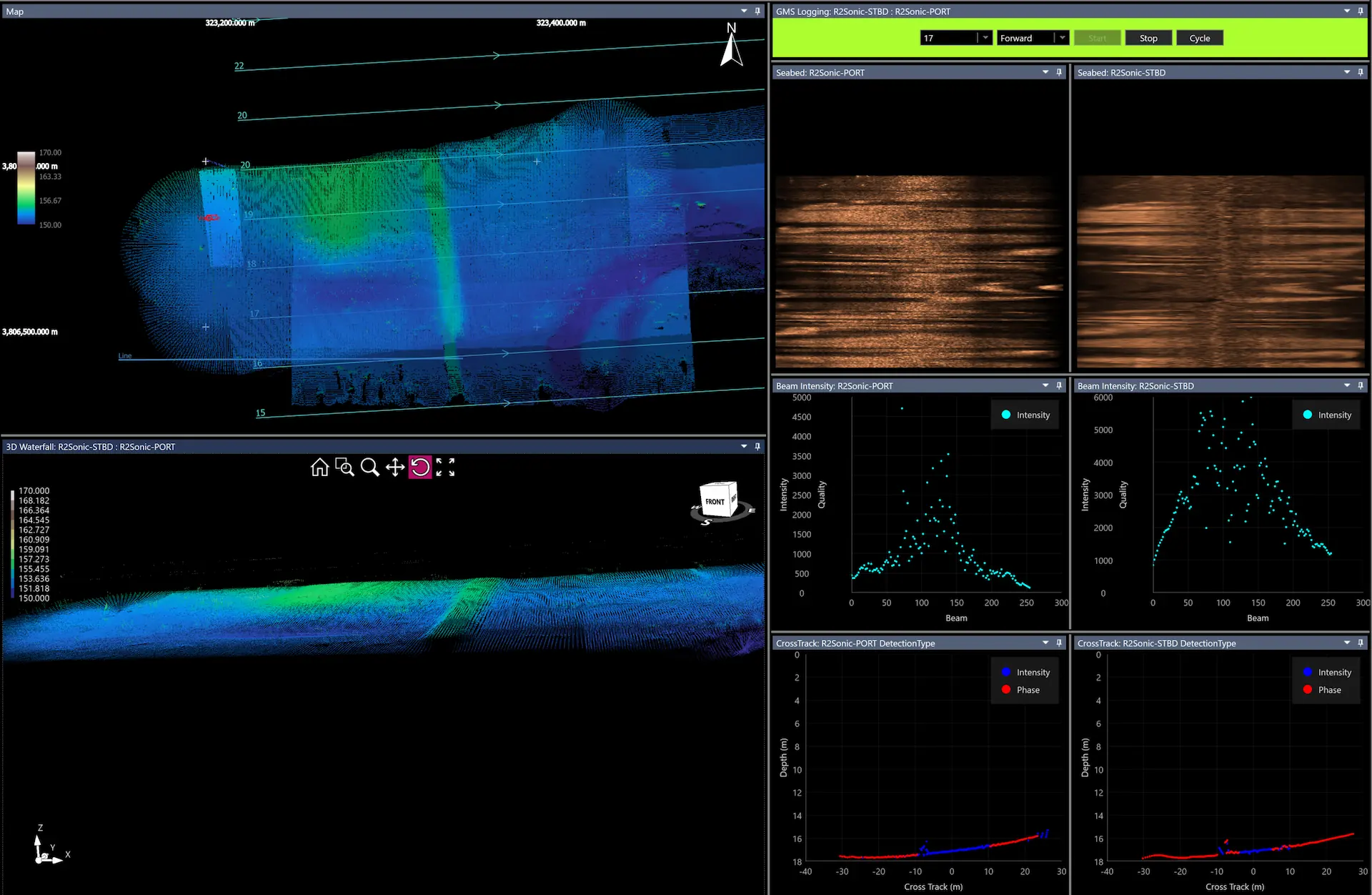
Reliable and precise data acquisition is essential for success.
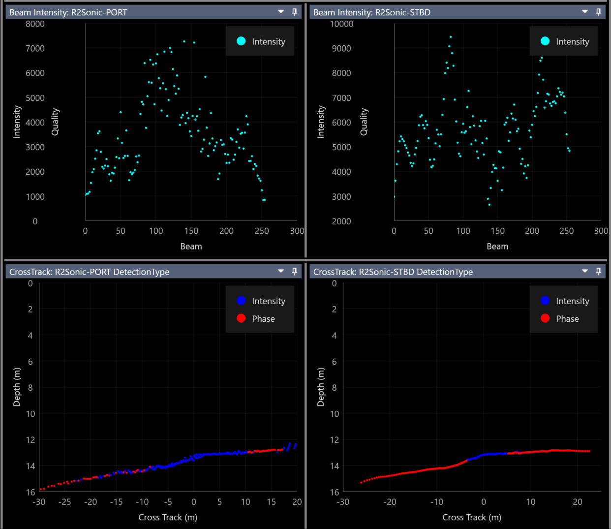
Data is collected from multibeam, positioning, depth, heading, and attitude sensors at a high rate during field operations. Operators can monitor sensor performance in real-time through various displays, which include information on detection types and beam intensity. As the survey vessel travels along its route, coverage is shown on a map to ensure that there are no gaps in the data. Our modern architecture minimizes the load on computer resources. All data is logged in a database and tagged with timestamps, ensuring that raw data remains accessible at all times.
Quality control is not just important
It is absolutely crucial for achieving success.
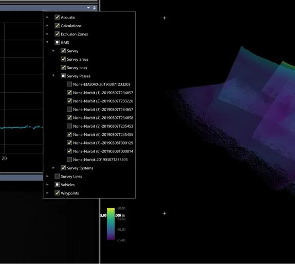
4D NAV has introduced an innovative concept called smart survey lines, which establish relationships between the data collected along a line and the line itself. When a vehicle follows a line while gathering data, we create a relationship known as a "pass." If the line is revisited, multiple passes are generated. These passes are organized in a hierarchical structure, enabling users to toggle individual passes on and off in the coverage map for easier result comparison
Powerful and intuitive data export functionality
Our main priority is the quality acquisition of multibeam data. You can process this data using your preferred data processing software. To support this, 4D Nav has created a data export utility that allows you to export datasets in any industry-standard format or a format that you define.
Ensure streamlined and safe offshore operations
For more information about our industry leading software, please reach out to schedule a demo.
BOOK A CALL