Solutions -Navview
Remote LBL
4D Nav’s remote LBL/INS solution (RLBL) significantly enhances our well-established NavView Remote Survey capability by offering comprehensive remote control over Sonardyne’s 6G and 6G+ LBL transceivers, along with Sprint Inertial Navigation Systems (INS). This integrated solution features seamless video and voice communications, allowing operators to monitor and control operations in real-time.
The RLBL system is designed to facilitate complex, high-accuracy subsea operations from an onshore location, thereby reducing the need for specialized personnel to be physically present on-site. As a result, this innovative approach not only streamlines field operations but also lowers operational costs, increases efficiency, and minimizes risks associated with offshore activities.
Standardized hardware configurations facilitate easy deployment and integration with the ROV, eliminating the need for your LBL expert to be onsite.
4D Nav has developed a standardized equipment spread with wiring schematics, and pre-made cables, allowing the offshore team to seamlessly integrate the equipment with the ROV. Once the setup is complete, the LBL expert can test all interfaces remotely via our ROCS. The testing process involves checking the interfaces from the ROV to the onboard computer and then to our onshore workstation.

Our Remote LBL solution enables a fully remote scenario where the equipment is sent offshore without a survey technician. Alternatively, we offer a hybrid solution in which a technician (from 4D Nav or our client) can be deployed to the vessel or rig to facilitate the equipment interface.
We create task plans for each project, which are sent to the offshore ROV operators for a complete remote solution. In the case of the hybrid solution, the technician will review the task plans with the ROV team onboard to ensure that the project is executed safely and efficiently.


Making calibrations and validations simple and straightforward.
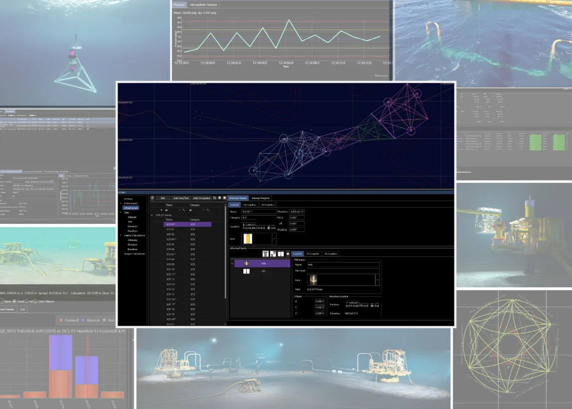
The RLBL solution offers intuitive, flexible tools for collecting LBL baselines needed for a calibration. Multiple methods such as individual baselines, batch mode, and simultaneous mode are supported. As data are collected, a realtime QC display complete with histograms and status may be used to ensure the integrity of the calibration.
Your ultimate solution for accurate positioning and navigation!
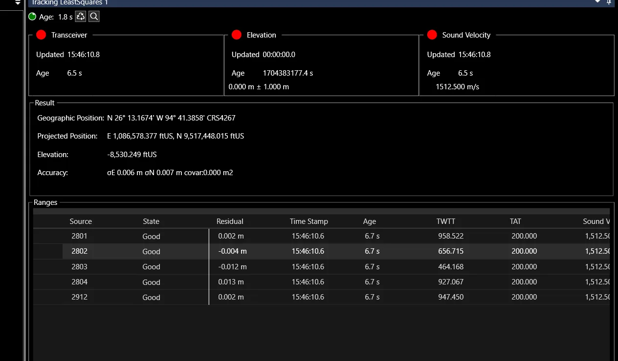
RLBL provides tracking and positioning calculations using a calibrated array. Reference points can be defined and selected on a subsea vehicle, and built-in map tools allow for the visualization of measurements. Depth and sound velocity sensors can also be incorporated to enhance the real-time tracking solution. All software modules within the RLBL system can be operated remotely or in a hybrid onshore-offshore mode, supporting multi-shift operations. Any changes made to sensors or reference points are applied globally to the project, thereby maintaining the integrity of the project across the entire hardware-software system suite.
Ensure streamlined and safe offshore operations
For more information about our industry leading software, please reach out to schedule a demo.
BOOK A CALL